Maps & Apps

Adopt A Road/Trail
Roads and trails that have been adopted or are available for adoption.
Aerial Photos 1928 - 2024
Aerial photography archive
Bike Map
View City of Kamloops bike routes, bike repair stations, and bike lockers.
Building Age
Approximate building construction age
Catch Basins Locator Map
Use this map to find nearby catch basins.
Cemetery Search
Search cemetery plots by name or location.
CityMap
City of Kamloops' property-based web mapping application.
Community Food Asset Map
This map is intended to help promote and build awareness of initiatives, programs, and community resources that support the local food system and help increase food access for residents.
Dangerous Goods and Truck Route
A detailed map outlining the dangerous goods routes, highway truck routes, and truck routes through the City of Kamloops.
Dog Park Map
Find on-leash and off-leash parks and beaches.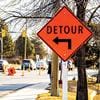
Emergency Operations
Emergency orders, evacuations, wildfire alerts and detours.
Heritage Property Tour
Heritage Property Web App Tour - shows the heritage properties throughout the City of Kamloops.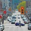
Kamloops Street Classifications
A hierarchy of urban streets throughout the city enables each class of street to serve its primary function, while promoting operational efficiency and safety throughout the network.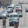
Kamloops Traffic Counts
Traffic count reports from around the city.
Kamloops Trees
Determine ownership of trees (whether or not it's on City property) and view Kamloops’ tree canopy.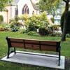
Memorial Tour
Shows memorial benches, plaques and trees throughout the City of Kamloops.

myKamloops App
Service requests, online services, parks & trails maps and more.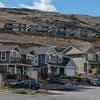
myNeighbourhood - Planning and Development
Development and Capital Projects throughout Kamloops.
Open Data Catalog
Free access to hundreds of data sets from a variety of categories.
Parks and Trails
This app allows you to search for parks either by park name or facility available within the park. It also highlights bike routes and trails throughout the city.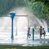
Parks Tour
Shows the various parks throughout the City of Kamloops.
Property Information Portal
Property maps, reports, information and permits.
Public Art Tour
Shows the public art throughout the City of Kamloops.
Public Washrooms
Publicly available washrooms in Kamloops. Washroom may be closed unexpectedly for maintenance.
Sharps Container Locations
Safe disposal sharps containers located around the City of Kamloops.
Snow Clearing
Snow clearing details for streets, sidewalks, and parking lots.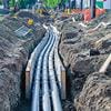
Underground Utility Locations
Find the utility infrastructure nearest your home.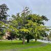
Urban Tree Tour
This self-guided tour showcases over 20 unique and remarkable trees throughout the city.
Voyent Alert! App
The City of Kamloops is using Voyent Alert! emergency alert service.